Topographic Survey Services
Comprehensive Topographic Surveying Expertise
As a trusted topographic survey company, UGCE Consultants provides accurate surveying solutions for a wide range of engineering and construction projects. Our topographic surveying services offer site surveying services that gather essential site data for residential, commercial, and infrastructure developments. Our surveying experts utilize their technical skills to deliver reliable results for both residential topographic surveys and major road topographic surveys.
")
Our comprehensive topographical land surveying service portfolio includes:
We use advanced technology such as GNSS, LiDAR, and drone-based photogrammetry to efficiently collect detailed spatial information. This combination of modern equipment and extensive industry expertise allows us to deliver high-precision results, making UGCE Consultants a leading provider of land surveying services in Egypt and the region.
UGCE Consultants follows a precise and systematic approach to ensure every 3D topographical survey is accurate, detailed, and tailored to project needs. Their method integrates advanced technology with deep topographic engineering expertise to deliver reliable data for planning, design, and construction.
")
Project Scope and Site Assessment
The process begins with a thorough understanding of the project’s requirements. UGCE Consultants evaluates the site and defines the scope of the survey, including the desired level of detail and specific features to be captured in the topographic survey drawing.
")
Data Collection Using Advanced Equipment
UGCE Consultants utilizes cutting-edge tools such as GNSS receivers, total stations, drones, and laser scanning topographic survey equipment to collect high-resolution spatial data. This technology allows for fast and precise mapping of terrain, structures, utilities, and natural features.
")
3D Modeling and Data Processing
Collected data is processed into accurate 3D topographical models using specialized software. This includes elevation points, contour lines, and feature mapping, which are essential for engineering analysis, design development, and construction site survey and planning.
")
Quality Assurance and Client Delivery
Before final submission, the survey results undergo rigorous quality control checks to ensure precision and completeness. UGCE Consultants then delivers the final outputs in digital and/or hardcopy formats, along with any required technical documentation, ensuring that clients receive dependable, actionable information.
")
Generation of Topographic Survey Drawings
Once the 3D data is validated, UGCE Consultants generates detailed topographic survey drawings that visualize the land’s surface, elevations, and key site elements. These drawings are formatted to meet the technical standards required by architects, engineers, and regulatory bodies.
Why choose UGCE Consultants for Topographic Surveys?
UGCE Consultants is known for its precision and professionalism in the field of topographic engineering, delivering reliable data that supports sound planning and design.
As a leading topographic survey company, UGCE Consultants has built a reputation for accuracy, consistency, and client
Our approach integrates modern surveying equipment and digital mapping tools, setting us apart from many other surveying companies in terms of detail and efficiency.
We ensure that our surveys are fully aligned with architectural, structural, and MEP requirements, helping reduce errors and streamline construction.
UGCE Consultants deliverables are widely respected by quantity surveyor consultants for their clarity, technical accuracy, and reliability in cost planning and project control.
Our team is committed to meeting deadlines and maintaining open communication, ensuring that every topographic survey supports the overall project schedule
Measured, Mapped. Delivered
UGCE Consultants provides comprehensive surveying services essential for projects in national infrastructure, industrial, energy, and agriculture sectors. Our services include:
For national and agricultural projects, we provide extensive topographic surveys and quantity estimations to inform land use and infrastructure. In the industrial and energy sectors, our services are critical for structural stability and regulatory compliance, supporting the design of marine terminals, pipelines, and industrial facilities. We use advanced technologies to deliver reliable data for safe, sustainable, and cost-effective development.
 (3)")
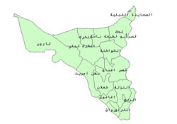
Projects Mapped by UGCE Consultants